Chapter 2
Misreading: Looking down at ourselves
Misreading: Looking down at ourselves
|
|
|
|
|
|


|
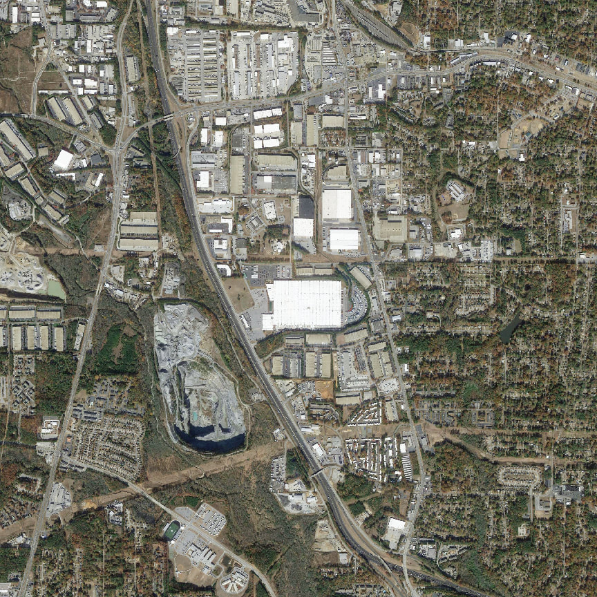
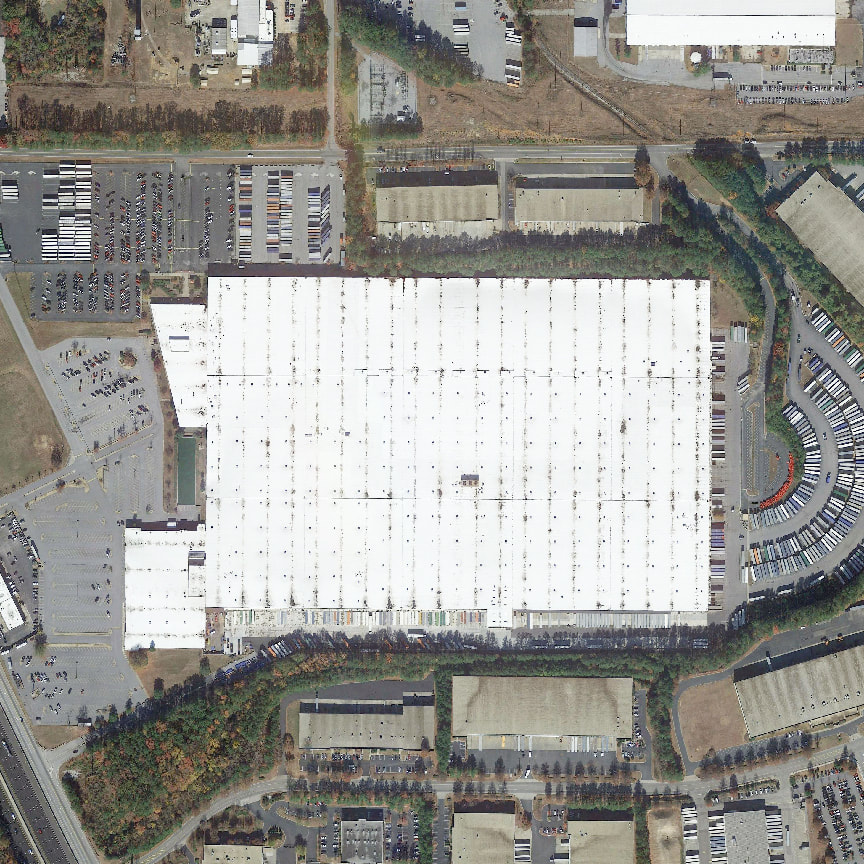
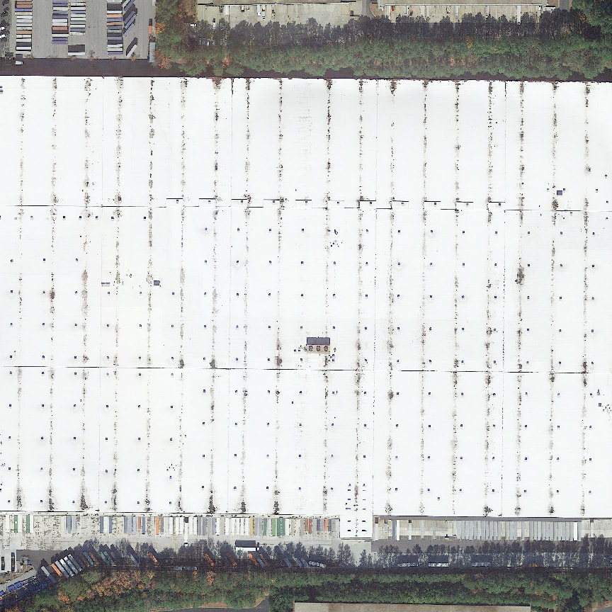
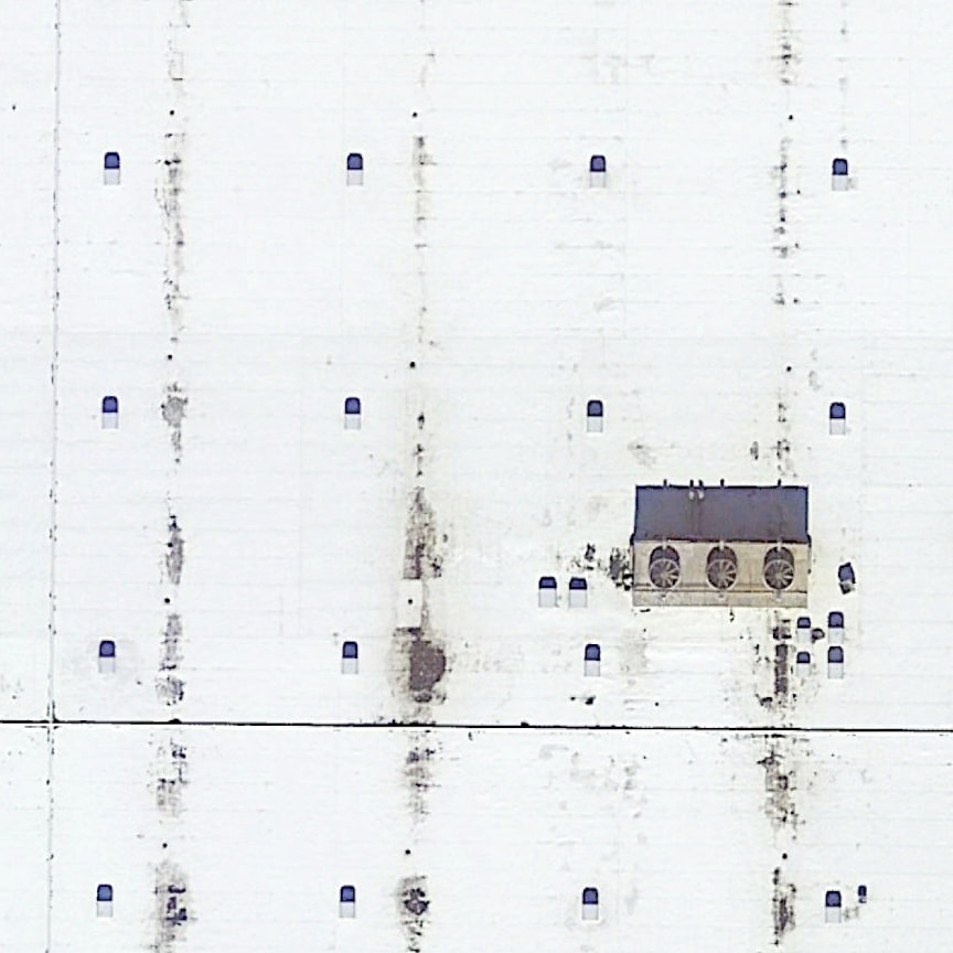
If we take a look at the digital world, one of the most used space is in the navigation apps, such as Google Maps and Google Earth. They direct us through the easiest and safest way, and provide us with the most popular destinations. Without traveling physically, we look at satellite images to understand our built environment. This thesis, then, takes Google Earth images as the medium, and redesigns an outlet mall building in Atlanta, Georgia, which hacks into the endless loop between the digital and the material.
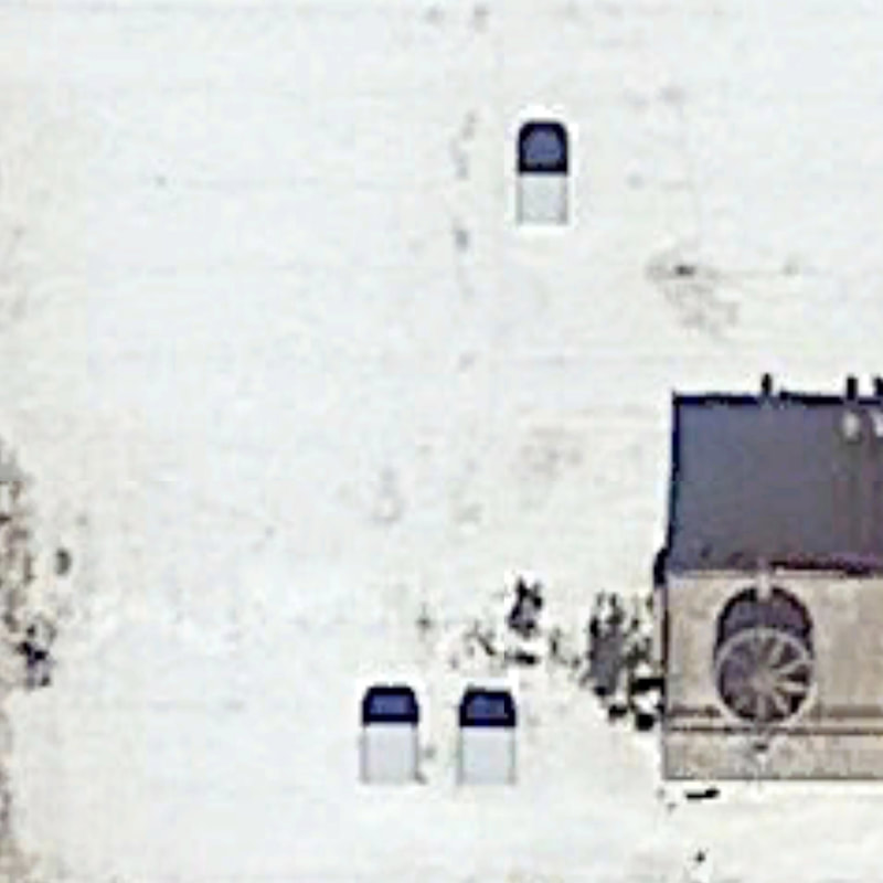
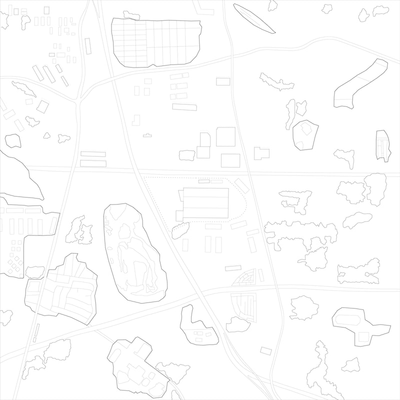
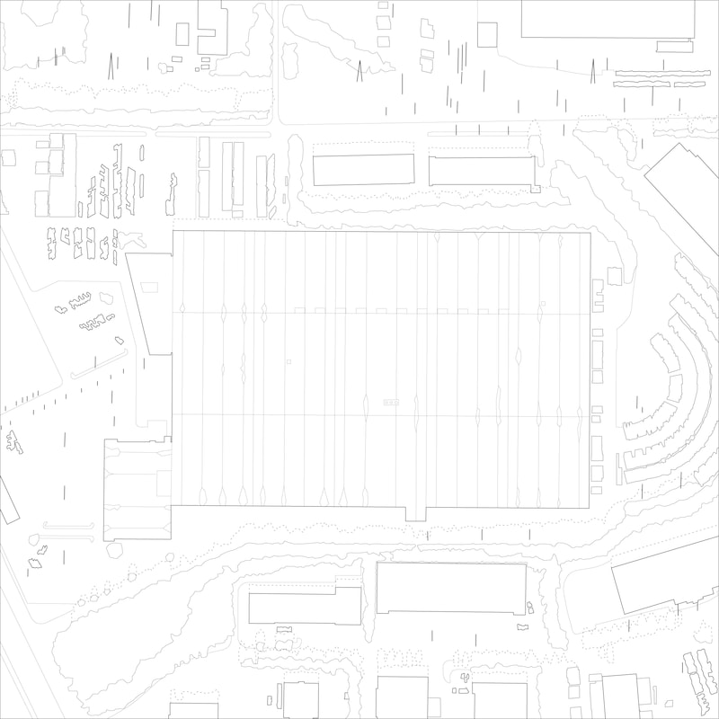
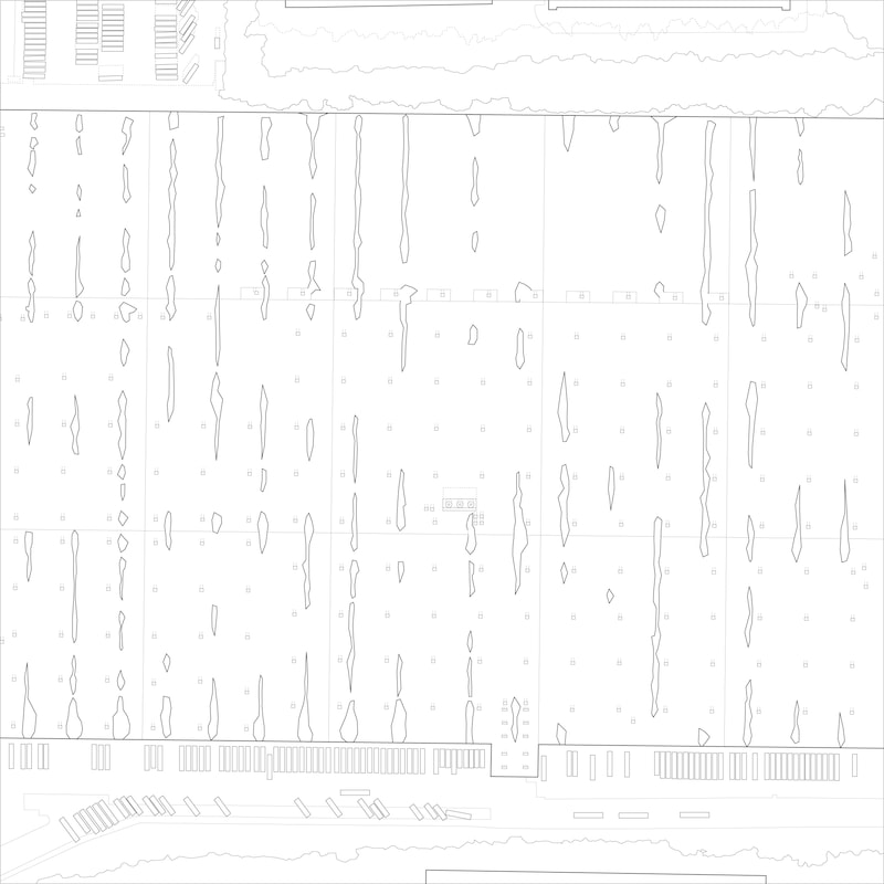
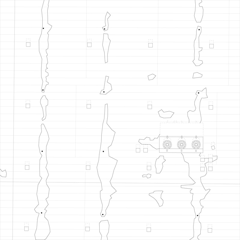
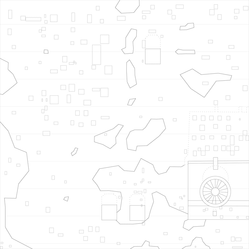
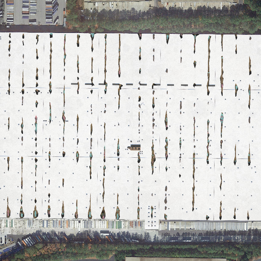
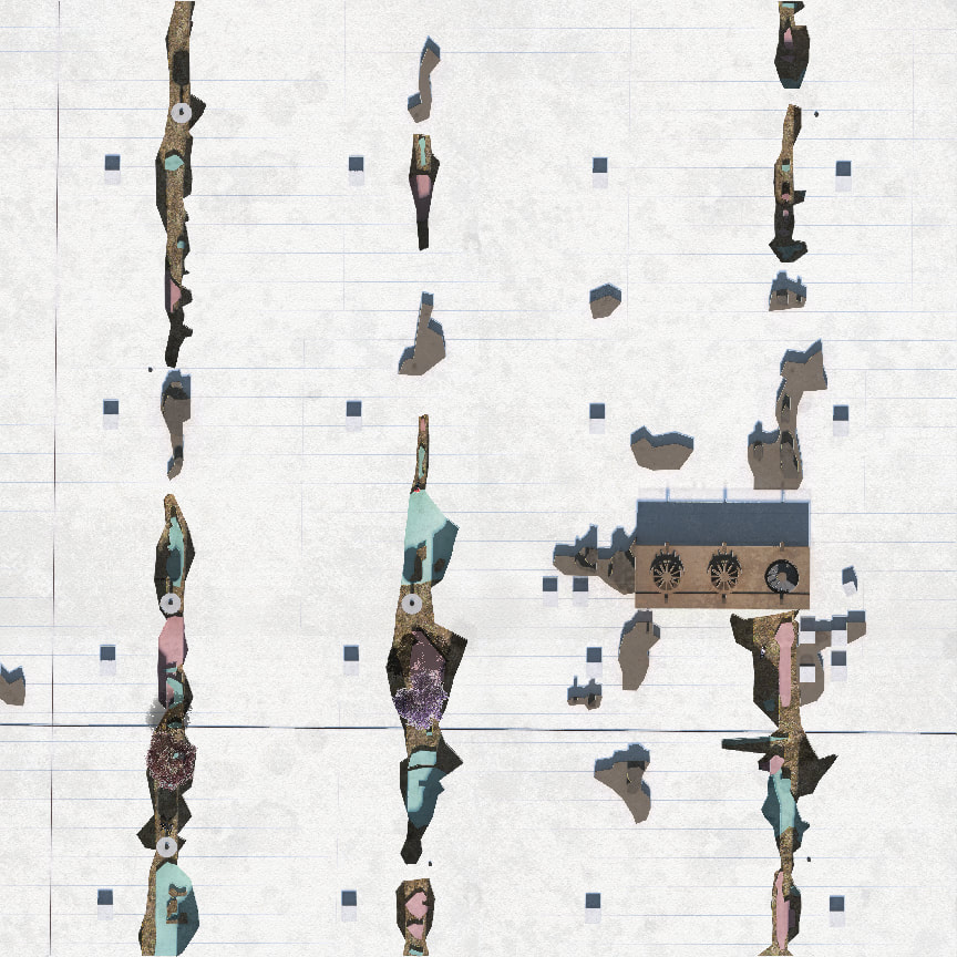
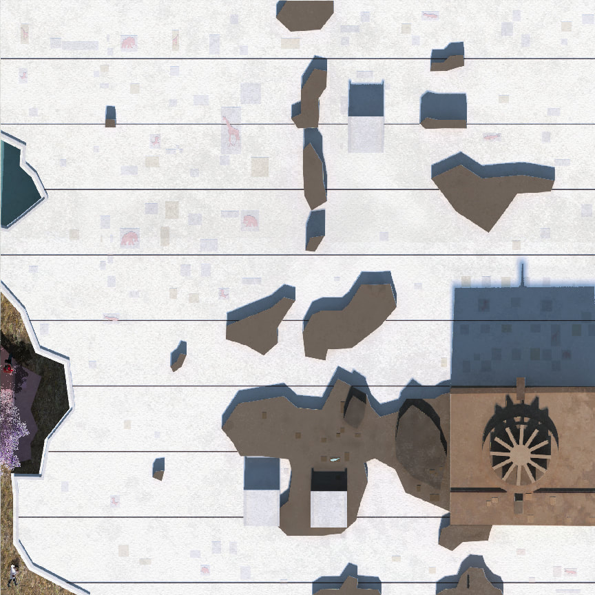
On top, you see 5 Google Earth images of the site of the thesis project: an outlet mall in Atlanta. It is one of the biggest mall in the US, covering land space equal to 1,200 football fields. It’s huge, flat, monolithic image floats in the sea of green and grey pixels of Google Earth. However, with the different zooms of Google images, we can start to understand this flat, monolithic, plain building in various ways. Oftentimes, they are also misread in different resolutions of images. They are camouflaged in layers of zooms, being both inscrutable and readily apparent at the same time. Through the process of tracing the Google images and redesigning the mall based on the tracing results, this quality of misreading is kept throughout the design process. For example, the courtyards of the new outlet mall look like stain or dust on the roof if we zoom out a bit more, which originally is just the stain or dust. Or, you realize one of the HVAC fan is actually a spiral staircase if you zoom in enough. |
Project done in CED, UC Berkeley | Year: 2017 | Primary Adviser: Neyran Turan | Secondary Adviser: M. Paz Gutierrez